Displaying 1 - 20 of 22
| Issues | Hydrocarbon Infrastructure | Notes | File | Longitude | Latitude | Depth (m) | X UTM35N | Y UTM35N | Provider | |
|---|---|---|---|---|---|---|---|---|---|---|
| View | 9 | Circular protection perimeter around Midia Maritime Terminal, with a 1.6 km radi More ... | point |
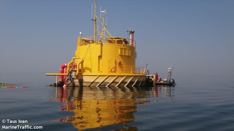 SPM_BUOY_MMT.jpg 34.80 KB  SPM_BUOY_MMT (1).jpg 53.81 KB |
28.46.29.40 | 44.17.47.40 | 641585.73 | 4906337.03 | DHM, MMT, MarineTrafic.com | |
| View | 81 |
Protection area around the hydrocarbon infrastructure. Anchoring, fishing with More ... |
poligon | 28.46.12.00 | 44.25.52.20 | 640876.95 | 4921286.95 | DHM | ||
| View | 81 | poligon | 28.46.58.80 | 44.25.29.40 | 641926.98 | 4920605.93 | DHM | |||
| View | 81 | poligon | 29.00.58.80 | 44.28.22.80 | 660368.58 | 4926387.4 | DHM | |||
| View | 81 | poligon | 29.18.39.00 | 44.30.31.20 | 683679.76 | 4930969.17 | DHM | |||
| View | 81 | poligon | 29.27.43.80 | 44.31.22.80 | 695660.83 | 4932912.76 | DHM | |||
| View | 81 | poligon | 29.20.29.40 | 44.36.04.20 | 685822.6 | 4941313.51 | DHM | |||
| View | 81 | poligon | 29.21.30.60 | 44.36.51.60 | 687129.44 | 4942814.95 | DHM | |||
| View | 81 | poligon | 29.28.13.80 | 44.32.30.60 | 696259.77 | 4935024.76 | DHM | |||
| View | 81 | poligon | 29.32.00.60 | 44.32.13.20 | 701281.29 | 4934641.27 | DHM | |||
| View | 81 | poligon | 29.31.52.20 | 44.32.46.80 | 701063.76 | 4935672.27 | DHM | |||
| View | 81 | poligon | 29.34.23.40 | 44.32.35.40 | 704411.16 | 4935424.84 | DHM | |||
| View | 81 | poligon | 29.34.38.40 | 44.31.37.80 | 704798.28 | 4933658 | DHM | |||
| View | 81 | poligon | 29.39.43.20 | 44.28.57.60 | 711687.18 | 4928930.8 | DHM | |||
| View | 81 | poligon | 29.38.50.40 | 44.28.06.60 | 710571.82 | 4927319.28 | DHM | |||
| View | 81 | poligon | 29.34.37.80 | 44.30.19.20 | 704861.57 | 4931232.33 | DHM | |||
| View | 81 | poligon | 29.32.13.80 | 44.29.49.80 | 701710.06 | 4930225.64 | DHM | |||
| View | 81 | poligon | 29.31.56.40 | 44.30.25.20 | 701291.94 | 4931306 | DHM | |||
| View | 81 | poligon | 29.27.21.60 | 44.29.30.00 | 695275.43 | 4929417.51 | DHM | |||
| View | 81 | poligon | 28.48.05.40 | 44.24.09.00 | 643454.19 | 4918157.46 | DHM |